Underwater Positioning

Underwater Positioning


At DBV Technology, we have developed a range of underwater GPS systems that provide navigation and positioning data for underwater vehicles and stationary instruments. We have developed two methods of underwater positioning, Portable Underwater GPS (PUG™) and Inverted Long Baseline (iLBL™). Both approaches utilize acoustic transmissions, leveraging our proprietary acoustic signaling package.

These solutions are flexible in operations by providing a combination of easily deployable surface buoys as well as other manned and unmanned surface platforms. With these solutions, we offer improved accuracy, higher update rates, lower latency, and streamlined logistics when compared to traditional underwater positioning methods. There are no seabed transponders to deploy and no surveys to be performed as in traditional long baseline systems

One Way Acoustic Transmission

Our positioning method utilizes one-way acoustic transmissions instead of the more traditional 2-way communication approach. By utilizing one-way communication, we are able to put more frequent transmissions into the water to acquire positional data faster and at a higher rate.

System Integration

Both PUG™ and iLBL™ share common hardware, software and system components. They offer end users the flexibility to select the approach that works best for their operational requirements. PUG has been implemented onto the SeaTrac Systems SP-48 USV and BlueRobotics BlueBoat USV. iLBL™ has been implemented onto our iBuoy™ and we are in the process of integrating with the JAIA Robotics micro-sized aquatic drone.

PUG™

Portable Underwater GPS


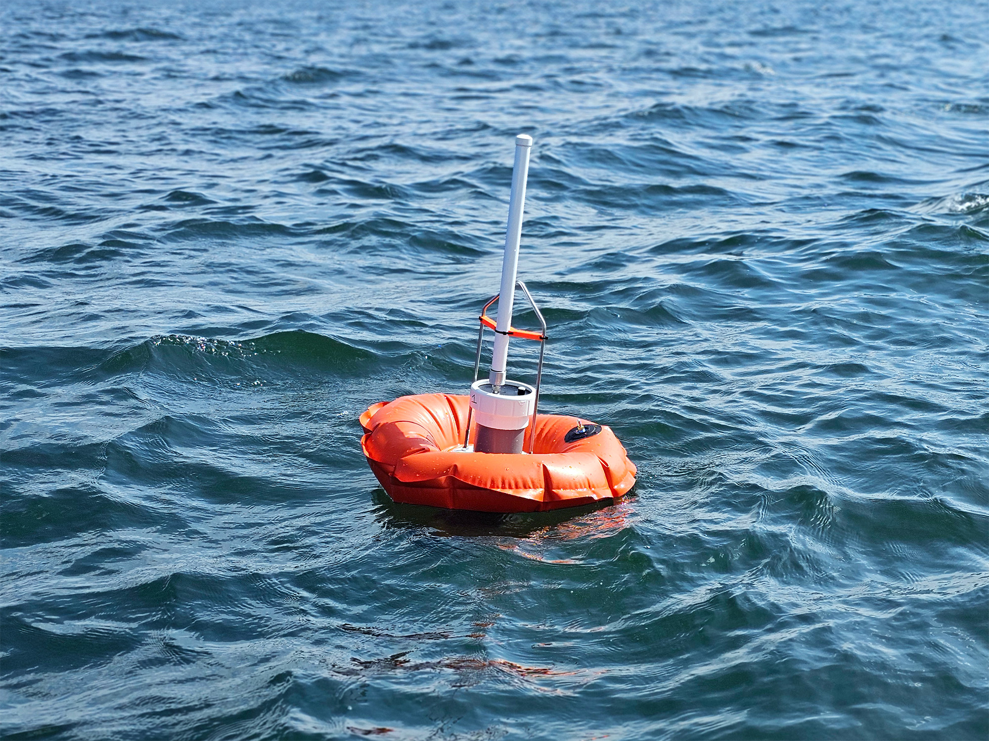
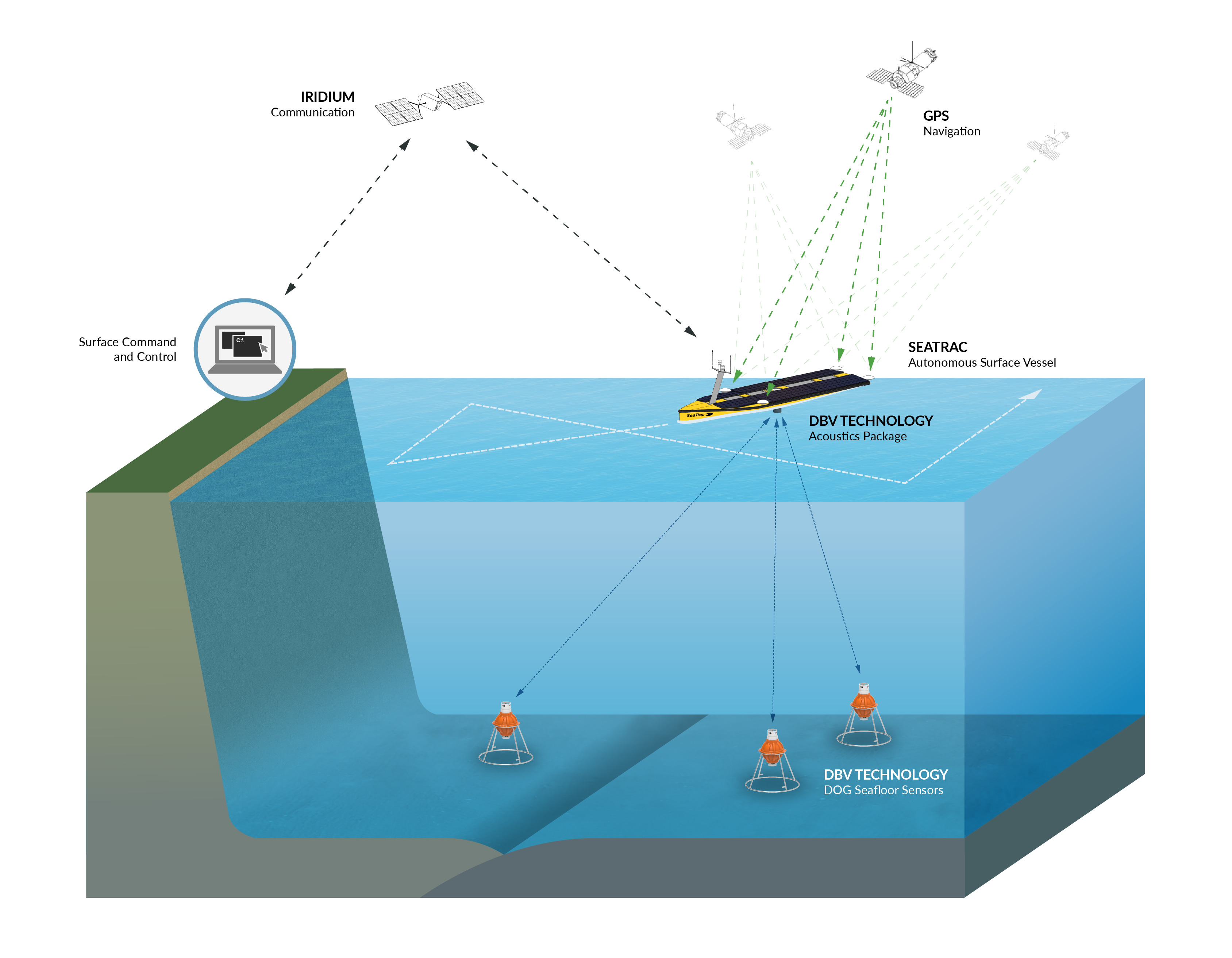
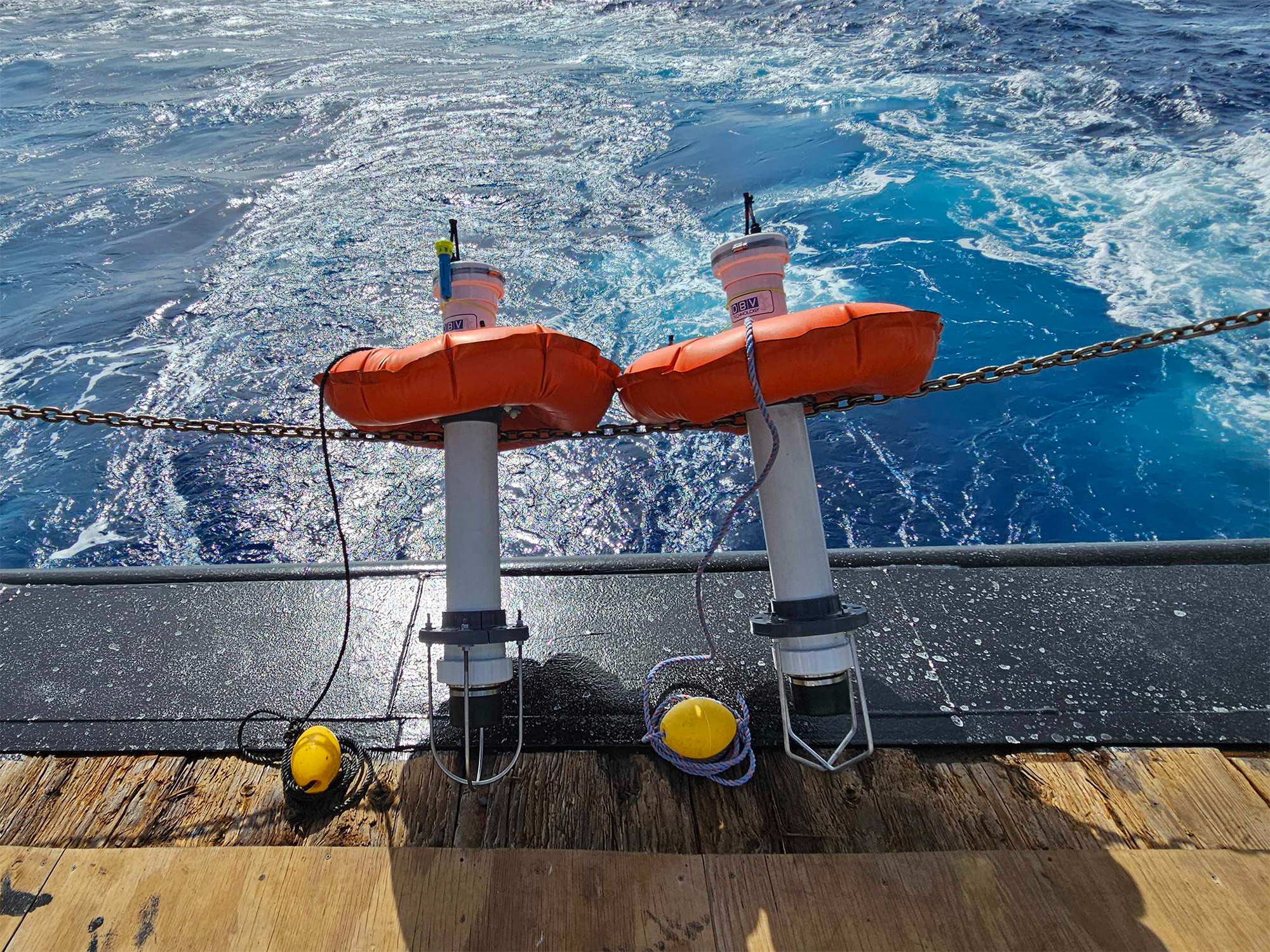
The PUG™ application functions by having several (3 or more) surface platforms transmitting downlink signals to an underwater receiver whose position is to be estimated. The surface platform can be a set of buoys or USVs with the PUG™ components integrated. The surface platforms transmit acoustic signals in a manner analogous to GPS satellites, with reference timing and surface GPS position embedded into the transmission. The compiling and processing of these transmissions is performed on the underwater asset (ROV, AUV, diver) to calculate its location in reference to the PUG™ surface platforms.


Application for PUG™

PUG™ was developed to provide underwater platforms with a position relative to GPS to assist in navigation. Our method, which implements continuous downlinks, allows for an unlimited number of underwater platforms to receive the transmissions and calculate their position. Because of this, it is ideal for experimentation and testing of swarms of undersea vehicles or other operations in which multiple undersea vehicles are simultaneously and independently operated within the same area.

iLBL™

Inverted Long Baseline


In the iLBL™ application, submerged assets are equipped with an acoustic transmitter (pinger) that emits uplink signals. This pinger can be a self-contained piece of equipment or integrated into an underwater asset. Positioning is performed by having 3 or more surface platforms receive the uplink transmissions and obtain timing measurements relative to the surface platform's GPS position and time. Measurements from all surface platforms are broadcast to a common base station by radio link for calculation and display of the submerged platforms position. iLBL™ achieves the benefits of traditional seafloor based long baseline transponders, but without the need for deployment and survey calibration. The use of iLbL™ one-way transmissions to surface platforms circumvents the limitations of acoustic propagation between assets operating in the same stratum, as seen in traditional long baseline.

Application for iLBL™

iLBL™ is a great choice when an operator needs to have continuous real time position of a submerged platform. The primary application for iLBL™ is the tracking of ROVs, where the ROV is tethered to the surface ship and the ROV navigator wants to be able to determine ROV position with high accuracy, high reliability, low latency, and at a high update rate.

Seafloor Geodesy

Underwater Positioning used to Study the Seafloor


We have applied our underwater positioning expertise to the academic field of Seafloor Geodesy, studying the movement of the tectonic plates that make up the seafloor. We've integrated our technology into surface platforms which communicate with deep ocean instruments that sit on the seafloor.

Illustrated below is our underwater positioning technology in the Seafloor Geodesy application. The surface platform consists of a USV equipped with PUG™ and the submerged platform contains an iLBL™ type receiver combined with a Chip Scale Atomic Clock (CSAC). In this configuration, the seafloor instrument is referred to as a Temporary Deep Ocean Geodetic (T-DOG™) sensor. We are able to survey the T-DOG™ sensors to determine their locations with sub-centimeter accuracy. Over time and after many surveys, we are able to observe the movement of the seafloor.

A prototype sensor underwent engineering development testing in the Puerto Rico trench in January 2023 as part of a long-term research effort with Princeton University.

If you'd like to learn more about our Underwater Positioning technology, please reach out.

Contact us